Tairāwhiti / East Coast
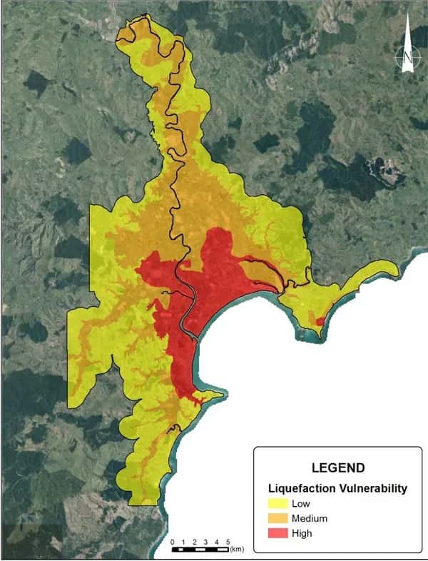
Gisborne Liquefaction Map
Project Overview
The Gisborne region is subject to significant seismic activity due to the proximity of the Hikurangi subduction margin off the east coast of New Zealand. Liquefaction is one of many natural hazards potentially caused by a large earthquake. It occurs when loose soils below the groundwater table lose strength and stiffness in response to an applied force such as earthquake shaking.
LDE provided technical input to map the liquefaction potential and vulnerabilities for Gisborne and Poverty Bay Flat regions.
This map would be the basis for determining appropriate site-specific levels of geotechnical assessment. This would assist Council to be better able to implement land use and building controls to develop greater resilience to liquefaction damage in the Gisborne areas.
Gallery
Project Details
- Location
- Gisborne
- Region
- Tairāwhiti / East Coast
.webp&w=2048&q=75)
.webp&w=2048&q=75)