
Experience
What a geophysical survey answers
Geophysics measures the ground without breaking it open. That matters in two situations: when the site cannot be disturbed (live services under a road reserve, a heritage setting, an urupā or cemetery, contaminated ground) and when the question is about the whole site rather than a handful of points. A borehole tells you what is under the borehole. A survey tells you what happens between them.
It is not a replacement for intrusive investigation and we do not sell it as one. The two answer different questions, and used together they are usually cheaper than either alone: the survey shows where the ground changes, and the rig goes to those places instead of a grid.
Depth to rockhead and weathering profile across a footprint, not at points
Shear-wave velocity and site subsoil class for seismic design
Buried services, tanks, voids and structures before anything is dug
Groundwater, fill and contamination extent
Targeting and scoping of the intrusive investigation that follows
Methods we run
Method selection is driven by the question, the ground and the access. Most projects use more than one, because the failure mode of geophysics is a single technique used past the point where it can resolve anything.
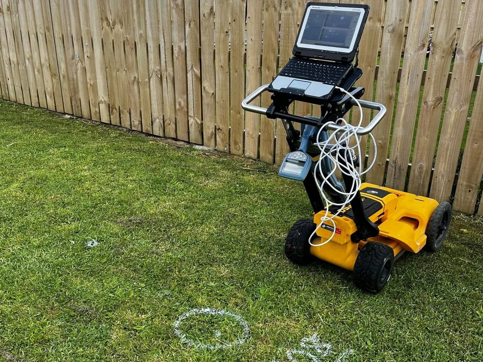
Ground penetrating radar (GPR): services, voids, reinforcement, buried structures and features
Seismic refraction: depth to rockhead, layer velocities and weathering profile
MASW surface-wave surveying: shear-wave velocity profiles and site subsoil class
Wireline (downhole) geophysics: logging the borehole itself to calibrate surface results
Electrical resistivity imaging: groundwater, fill, contamination and buried features
Magnetometry and EM surveys: buried metal, tanks, drums and archaeology
Electromagnetic induction for full underground service location
Seismic surveying and site subsoil class
Site subsoil class drives the seismic design of almost every building in New Zealand, and on soft or variable ground it cannot safely be assumed from a map. Seismic refraction and MASW measure it on the site: refraction gives the layering and depth to rock, MASW gives the shear-wave velocity profile that the classification actually depends on.
Because the survey covers a footprint rather than a point, it also shows where the classification changes across a site, which is the case that catches out a design based on one borehole in the corner of the block.
Wireline and downhole geophysics
Wireline geophysics logs the borehole itself. A probe run down the hole records the properties of the material it passes through continuously, rather than at sample intervals, and that log is what ties a surface survey to known strata.
The pairing is the point. A surface survey over a wide area is an interpretation until something calibrates it; a downhole log calibrates it. That is what makes a geophysical result defensible in a design report or a consent application rather than indicative.
What this has looked like on real sites
We have used ground penetrating radar to define the extent of a cemetery affected by flooding, identifying both marked and unmarked graves so the area needing protection could be established before any intrusive work was scoped.
On a proposed building development at Dent Street in Whangārei we combined ground penetrating radar with electromagnetic induction and other geophysical equipment to complete a full underground service location, mapping known and unknown services through the berm, footpath and road reserve and surveying the results into CAD for the design team.
Where we work
Geophysics runs out of our offices across New Zealand. Survey crews mobilise nationally for larger programmes.
Results are surveyed to real coordinates, delivered as GIS-ready layers or CAD for the design team, and interpreted by the same engineers who write the geotechnical report, so the survey answers a design question instead of arriving as a standalone dataset.
Geotechnical drilling alongside the survey
A geophysical survey covers ground quickly and a borehole tells you exactly what is under one point. Most sites are better served by both, so we plan geotech drilling and the survey as one programme. The survey finds where the ground changes across the site, and the holes go where that change matters instead of on an even grid.
The logged holes then calibrate the survey. That is the step that turns a velocity profile into a site subsoil class a designer can put in a set of calculations, and it is why the same engineers plan the drilling and interpret the geophysics.
Concrete scanning and utility locating
Before anyone cuts, cores or digs, the useful question is what is already in there. Ground penetrating radar answers it without breaking the surface. Concrete scanning maps the reinforcing, post-tension cables and conduit inside a slab so a penetration can be set where it will do no harm, and rebar scanning tells you whether the cover the drawings promised is the cover that was poured.
The same method works below ground. Utility locating and underground service locating before excavation keeps a machine off a live cable, and on a site with as-builts that nobody trusts it is quicker than potholing every alignment to find out. All of it is non destructive testing: the point is to know what is there without opening anything up to look.
Common questions about geophysical surveying
What does a geophysical survey tell you that a borehole cannot?
A borehole tells you what is under the borehole. A survey tells you what happens between them. Geophysics measures the ground without breaking it open, so it covers a whole footprint rather than a handful of points: depth to rockhead and weathering profile, buried services, tanks, voids and structures before anything is dug, and the extent of groundwater, fill and contamination.
Which geophysical methods do you run?
Method selection is driven by the question, the ground and the access, and most projects use more than one. We run ground penetrating radar, seismic refraction, MASW surface-wave surveying, wireline downhole geophysics, electrical resistivity imaging, magnetometry and EM surveys, and electromagnetic induction for full underground service location.
Can a survey give me a site subsoil class?
Yes. Seismic refraction and MASW measure it on the site rather than assuming it from a map: refraction gives the layering and depth to rock, and MASW gives the shear-wave velocity profile the classification depends on. Because the survey covers a footprint rather than a point, it also shows where the classification changes across a site.
Does a survey replace intrusive investigation?
No, and we do not sell it as one. The two answer different questions, and used together they are usually cheaper than either alone: the survey shows where the ground changes, and the rig goes to those places instead of a grid. The logged holes then calibrate the survey, which is what turns a velocity profile into a site subsoil class a designer can use. See geotechnical.
Can you scan concrete and locate services before we cut or dig?
Yes. Ground penetrating radar answers that without breaking the surface. Concrete scanning maps the reinforcing, post-tension cables and conduit inside a slab so a penetration can be set where it will do no harm, and rebar scanning tells you whether the cover the drawings promised is the cover that was poured. Utility locating before excavation keeps a machine off a live cable.
Where do you run geophysical surveys?
Geophysics runs out of our offices across New Zealand, and survey crews mobilise nationally for larger programmes. Results are surveyed to real coordinates, delivered as GIS-ready layers or CAD for the design team, and interpreted by the same engineers who write the geotechnical report. Find your nearest office.