
Experience
Our experience
Natural hazards shape where and how New Zealand builds. From the Tairāwhiti region hit hard by Cyclone Gabrielle to steep, seismically active catchments nationwide, our engineers and scientists help clients understand the risk, design for it, and get communities back on their feet after an event. We work alongside councils, insurers, iwi and asset owners across the full cycle, from hazard assessment and resilient design through to emergency response, reinstatement and long-term adaptation.
Flood and stormwater resilience
We quantify flood risk and design drainage and land-development that stands up to extreme rainfall.
Catchment and flood modelling
Overland flow-path and inundation mapping
Stormwater capacity and freeboard assessment
Water-sensitive urban design and detention
Flood-hazard input to resource consents
Slope stability and landslides
We assess unstable ground and design works that keep slopes, roads and buildings safe.
Landslide and slope-hazard mapping
Slope stability analysis and monitoring
Retaining and ground-stabilisation design
Debris-flow and erosion mitigation
Seismic and liquefaction
We characterise seismic ground conditions and design robust foundations to New Zealand standards.
Site subsoil classification
Liquefaction and lateral-spread assessment
Ground improvement design
Earthquake-resilient foundation design
Coastal hazards and erosion
We help clients adapt low-lying and coastal land to erosion, inundation and rising seas.
Coastal erosion and inundation assessment
Sea-level-rise adaptation planning
Coastal protection and revetment design
Managed-retreat and resilience advice
Emergency response and recovery
When an event hits, we mobilise fast to assess damage and design the rebuild.
Rapid post-event damage assessment
Geotechnical reconnaissance and reporting
Reinstatement and rebuild design
Resilience and business-continuity planning
Experience across New Zealand
Our hazards work covers the full cycle, from mapping risk before anything happens to designing the rebuild afterwards. After Cyclone Gabrielle in February 2023 we moved from voluntary emergency response into urgent technical support with Hawke’s Bay Regional Council, remediating two stopbank breaches at Maraenui within a month and reinstating flood protection to the lower Heretaunga Plains. In Northland a team of eight assessed 380 landslides across the Far North roading network after a major rainfall event, investigating over 100 in detail.
Before the event, the work is mapping and land-use advice. We provided the technical input for the liquefaction potential map covering Gisborne and the Poverty Bay Flats, which the council uses to set site-specific assessment requirements; carried out lateral spread mapping and geological modelling across Christchurch and Kaiapoi after the 2011 earthquakes; and mapped a 235-hectare site in Auckland’s Southern Landslide Zone to establish where development is feasible at all. On the coast we designed erosion protection at Blacks Beach and the East Cape Road revetment at Te Araroa.
Emergency stopbank remediation after Cyclone Gabrielle, Heretaunga Plains
380 landslide assessments, Far North roading network
Liquefaction potential mapping, Gisborne and the Poverty Bay Flats
Lateral spread mapping and geological modelling, Christchurch and Kaiapoi
Geomorphic hazard mapping, Southern Landslide Zone, Whitford
Coastal erosion protection, Blacks Beach and East Cape Road
Stopbank stability and liquefaction assessment, Waipaoa River
Mobilising after an event
The first fortnight after a major event is not a normal engineering job. Access is restricted, ground is saturated, materials are short and the people making decisions are exhausted. What matters then is having engineers who already know the geology and the network, who can make a defensible call quickly, and who will keep records good enough to survive the review that follows twelve months later. We have offices in the regions that get hit, which is the practical reason we can be on site within a week rather than a month.
Common questions about natural hazards and emergency management
What does your natural hazards work cover?
Natural hazards work here runs from flood and landslide risk to earthquakes, liquefaction and coastal erosion. We pair geotechnical, civil and water expertise with rapid post-event assessment and resilient rebuild design, working alongside councils, insurers, iwi and asset owners across the full cycle: hazard assessment, resilient design, emergency response, reinstatement and long-term adaptation.
How quickly can you get to site after an event?
We have offices in the regions that get hit, which is the practical reason we can be on site within a week rather than a month. The first fortnight after a major event is not a normal engineering job: access is restricted, ground is saturated, materials are short, and what matters is engineers who already know the geology and the network. Find your nearest office.
What did you do after Cyclone Gabrielle?
We moved from voluntary emergency response into urgent technical support with Hawke’s Bay Regional Council, remediating two stopbank breaches at Maraenui within a month and reinstating flood protection to the lower Heretaunga Plains. In Northland a team of eight assessed landslides across the Far North roading network after a major rainfall event, investigating over a hundred in detail.
Do you map hazards before an event as well?
Yes. Before the event, the work is mapping and land-use advice. We provided the technical input for the liquefaction potential map covering Gisborne and the Poverty Bay Flats, which the council uses to set site-specific assessment requirements, carried out lateral spread mapping and geological modelling across Christchurch and Kaiapoi, and mapped a site in Auckland’s Southern Landslide Zone.
Can you assess flood risk and design for it?
Yes. We quantify flood risk and design drainage and land development that stands up to extreme rainfall: catchment and flood modelling, overland flow-path and inundation mapping, stormwater capacity and freeboard assessment, water-sensitive urban design and detention, and flood-hazard input to resource consents.
What can be done about coastal erosion and rising seas?
We help clients adapt low-lying and coastal land to erosion, inundation and rising seas, through coastal erosion and inundation assessment, sea-level-rise adaptation planning, coastal protection and revetment design, and managed-retreat and resilience advice. We designed erosion protection at Blacks Beach and the East Cape Road revetment at Te Araroa. More under coastal and marine.
Recent Projects
Project Experience across our natural hazards & emergency management work.
.webp&w=2048&q=60)
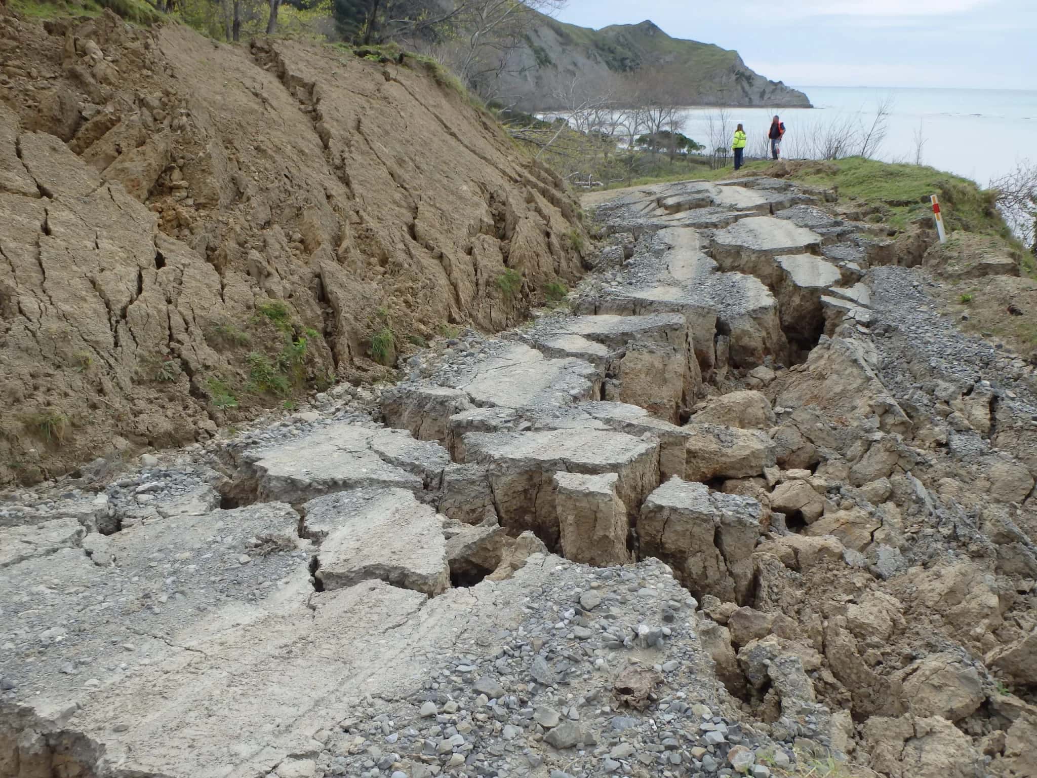
Beach Road Coastal Protection Works
Gisborne District Council
Tokomaru Bay, East Coast
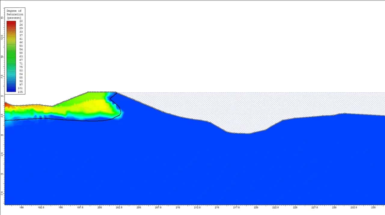
West Coast Stopbank Upgrades
West Coast Regional Council is working hard to enhance flood protection infrastructure along the Hokitika, Orowaiti, and Buller Rivers in New Zealand’s South Island. WGA is working with Davis Ogilvie to support Council to upgrade the existing stopbanks at Hokitika, and to…
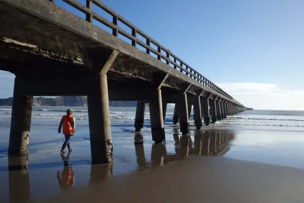
East Cape Wharf Inspections
Following Cyclone Pam, the three main wharves of the East Cape required structural inspections for any damage or defects resulting from the storm. Wharves inspected were; LDE completed full visual inspections on each of the wharves. This included load checks for structure...
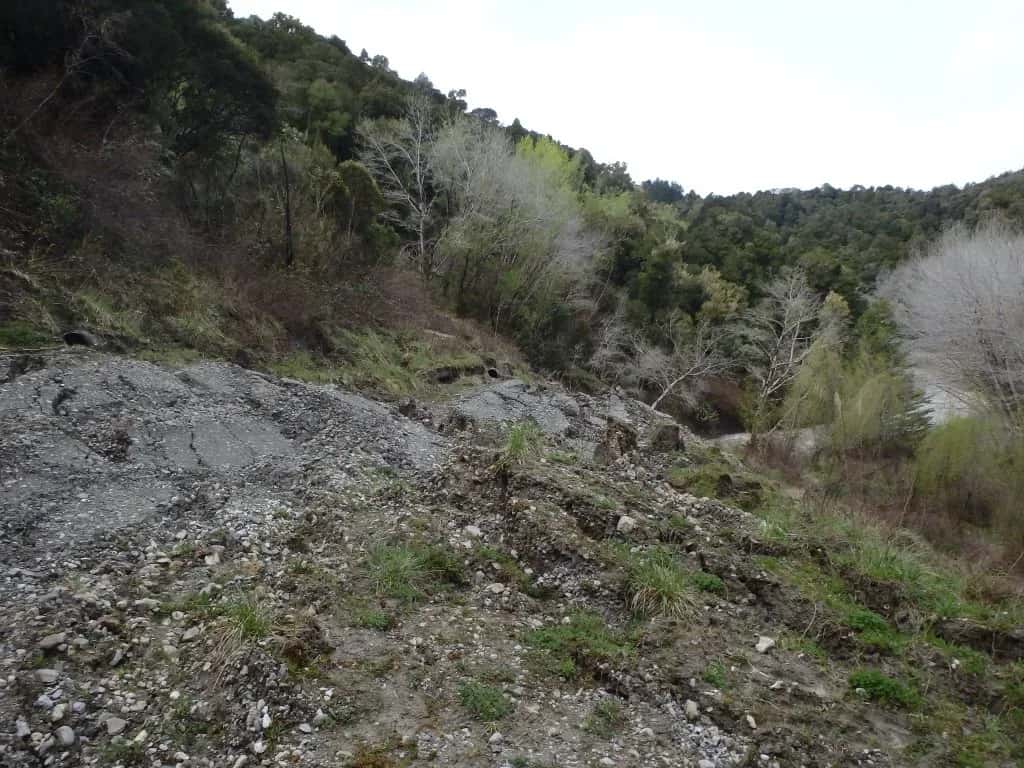
Tauwhareparae Road Landslide
Tauwhareparae, Gisborne
LDE provided comprehensive geological assessments and analyses of the significant landslide and sections of the affected road. The road traverses across the top of a narrow section of the ridge which drops away steeply for several tens of metres on either side. The southern...
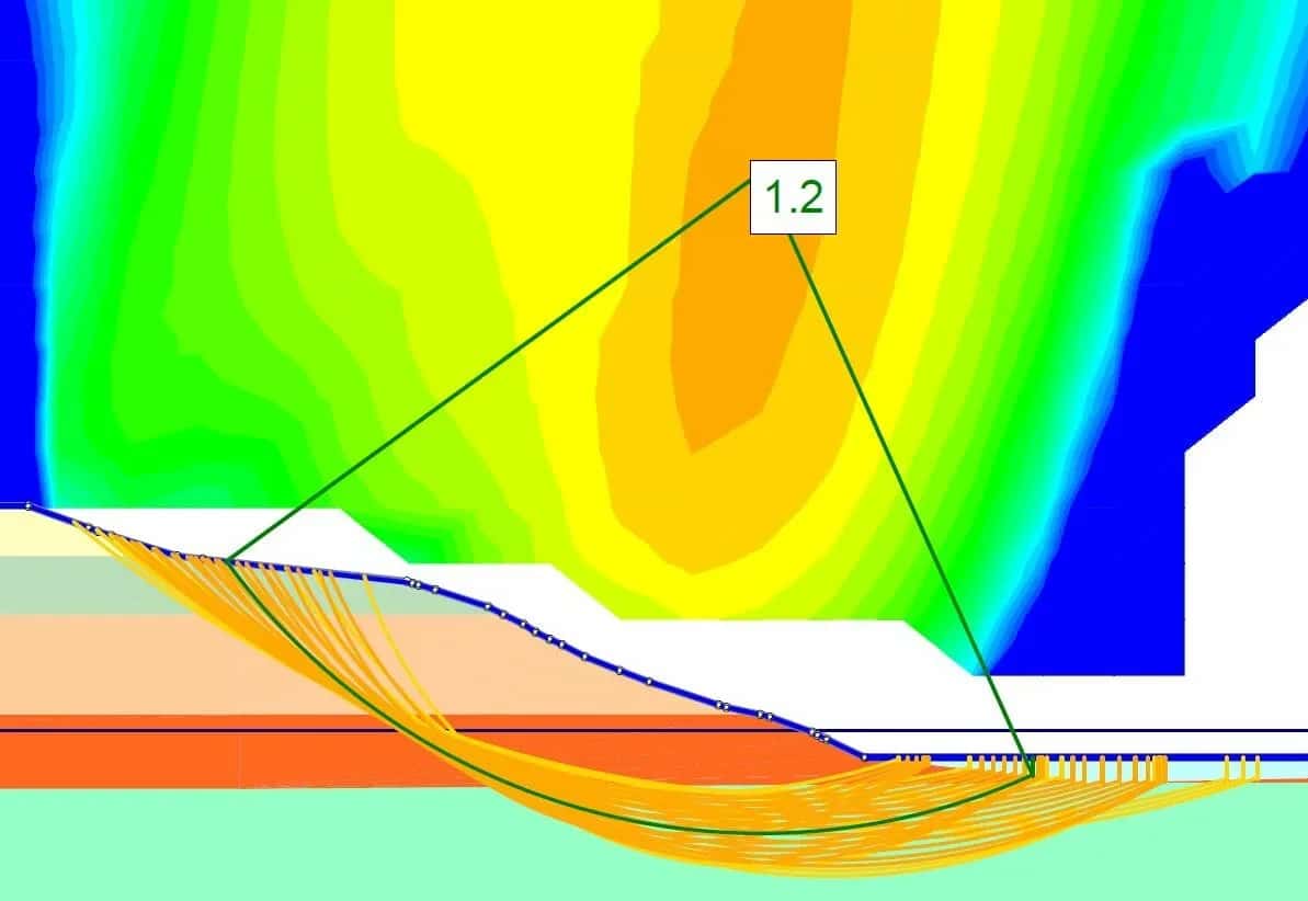
Waipaoa River Stopbank Assessment
LDE conducted geotechnical investigations, stability and liquefaction-induced damage assessments along 50km of the river stopbank.
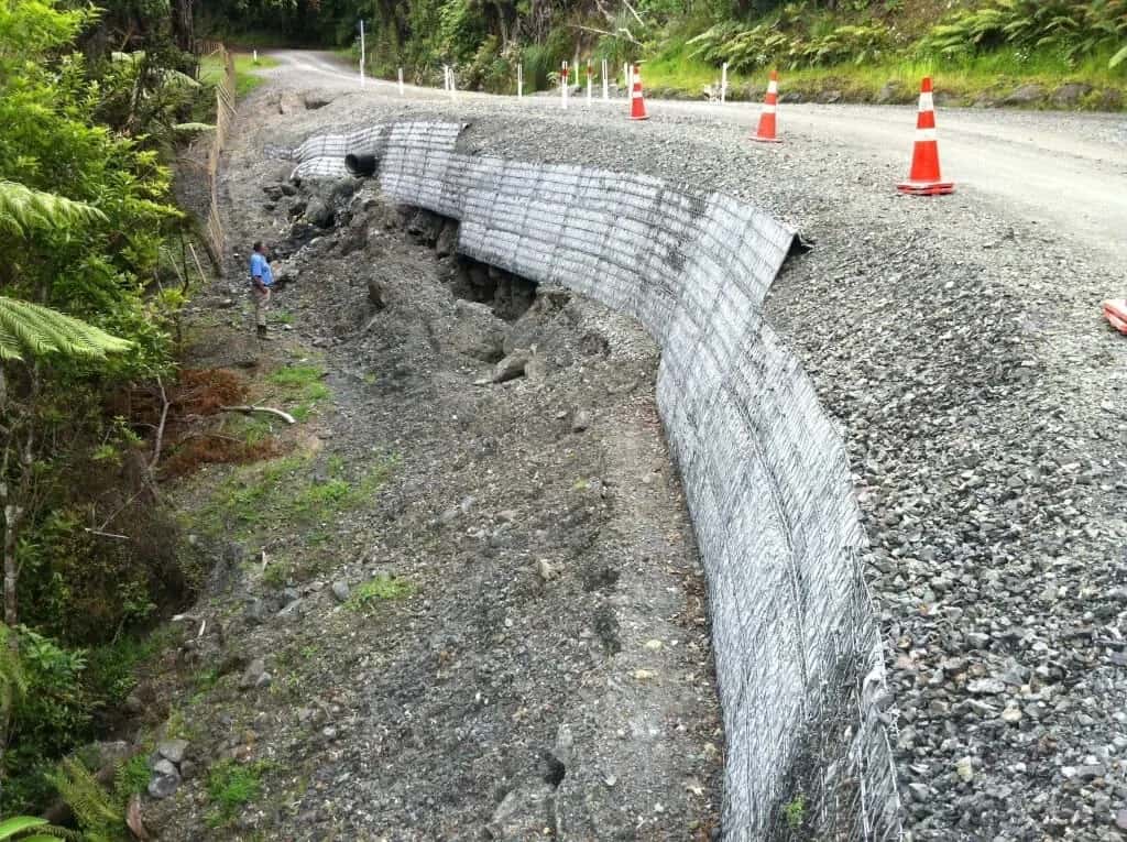
Northland Roading Network Preventative Landslide Investigations
LDE provided preventative landslide investigations for FNDC. We investigated and determined remedial solutions for ten large landslides affecting parts of the Northland roading network.
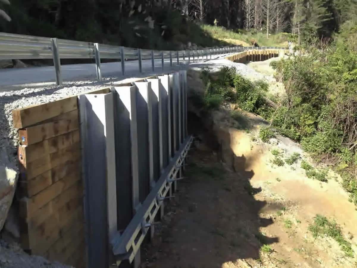
Pīpīwai Road Drop Out Repair
Northland
A dropout occurred within the road formation and undercut and removed the road pavement along Pīpīwai Road. Road access was also affected by the slips. Emergency remedial works were actioned to allow the road to reopen to traffic. To stabilise the wide area of land slippage...
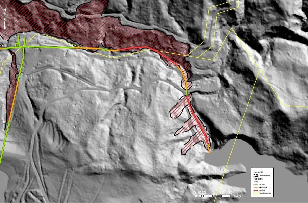
Waingake Water Supply Pipeline Hazard Assessment
LDE undertook an assessment of a section of the Waingake Water Supply Pipeline extending from the intersection of Tarewa Road/Rabbit Road down to the Te Arai Stream. The purpose of the assessment was to review the stability of the ground along the pipeline route, identifying...
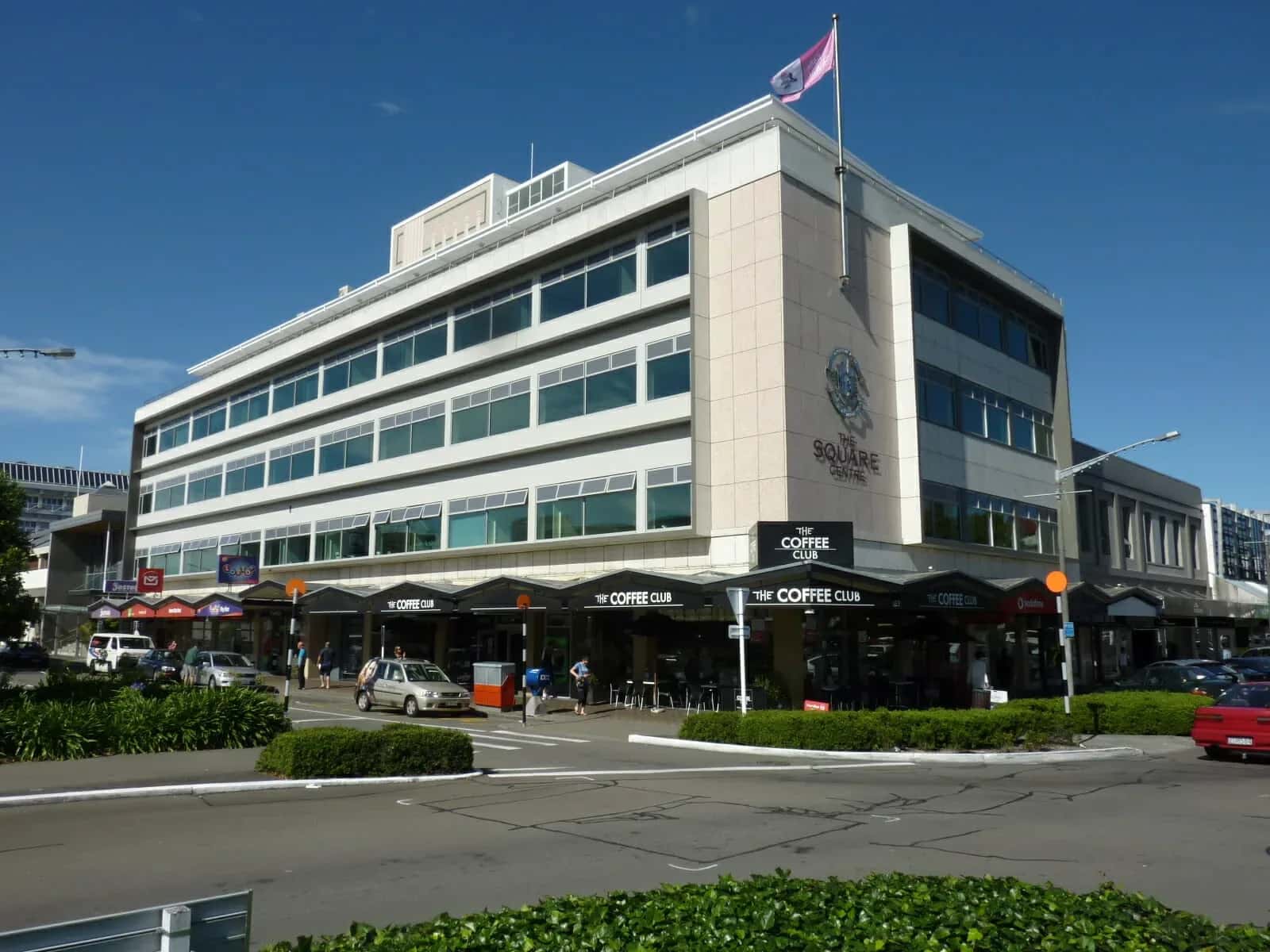
Palmerston North Seismic Strengthening
Palmerston North
The Square is at the heart of Palmerston North and a focal point within the city. LDE provided a geotechnical investigation report relating to the seismic strengthening of building foundations. This Palmerston North Seismic Strengthening project included a site-specific design...
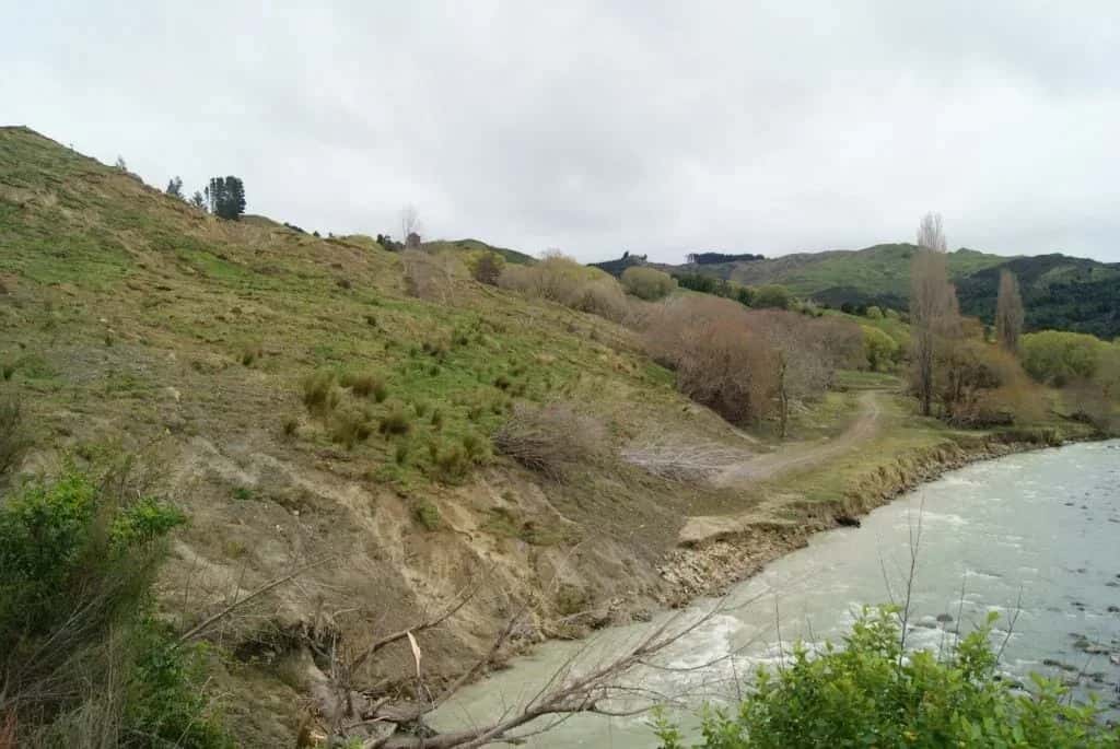
Nuhaka River Road Landslide
Nuhaka
We assessed a massive landslide, measuring 2km in length, 800m in width, and 50m in depth, which caused the severing of Nuhaka River and Mangone Roads. Our work involved exploring options for diverting the river and realigning the roads to accommodate the landslide’s presence....
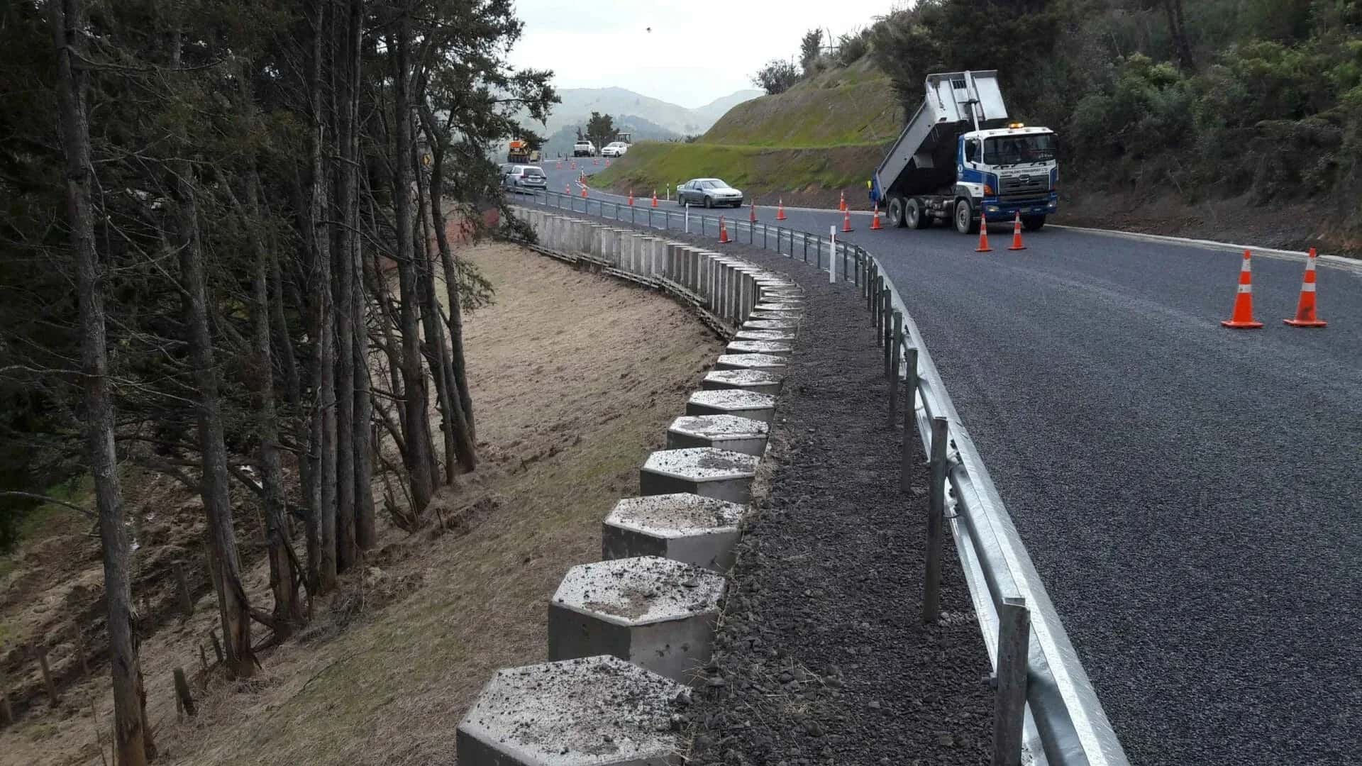
Mangakāhia Road Stabilisation
Northland
Land movement affected an approximately 70 m-long section of Mangakāhia Road and required a deeper level of investigation. LDE was engaged to carry out the investigation, design and construction supervision of an 11m high reinforced concrete anchored retaining wall.
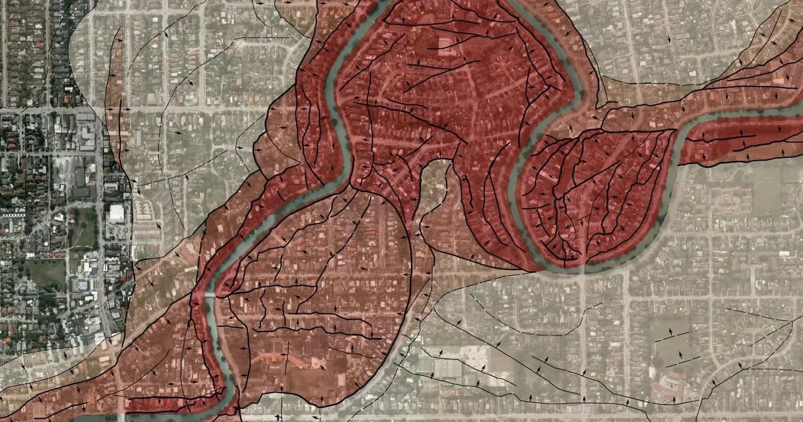
Christchurch and Kaiapoi Lateral Spread Mapping
LDE took on the exclusive responsibility of lateral spread mapping deformation across the entire Christchurch and Kaiapoi areas in the aftermath of the February 2011 earthquakes, providing critical geology information on the extent and impact of the seismic events.