Hydrogeology in Auckland
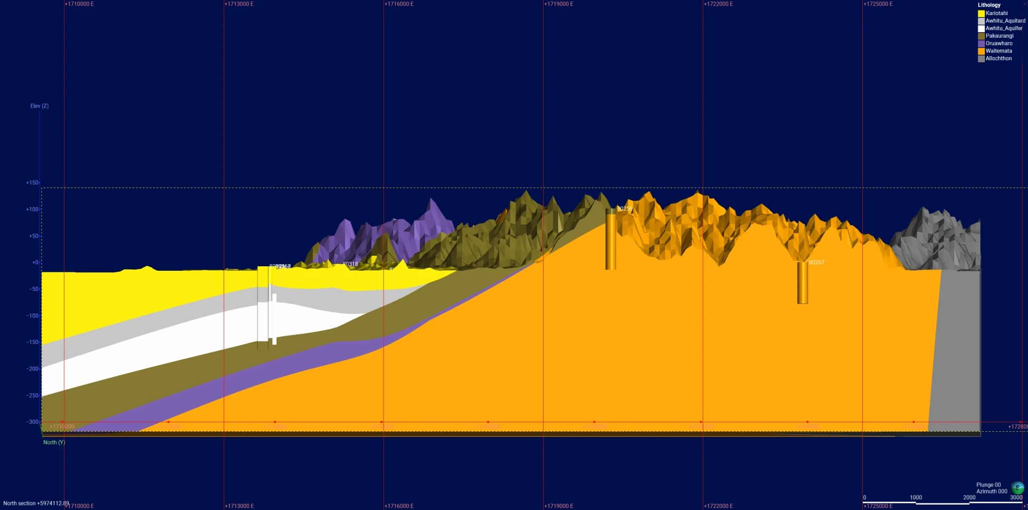
Beneath central Auckland the groundwater story is shaped by East Coast Bays Formation papa, the volcanic field and reclaimed waterfront ground, and it matters more than most people realise. Hydrogeology is the science of understanding that groundwater: how it sits in the rock and fill, how it interacts with the harbour, and how contamination from a long industrial history moves through it.
LDE provides hydrogeology for city-centre and waterfront projects, characterising aquifers and perched groundwater, building conceptual models, and assessing contamination and the saline interface near the coast. We interpret groundwater monitoring, support contaminated-land investigations, and give developers and project teams the understanding they need where deep development meets the water table.
This is investigation and assessment work, separate from the engineering that controls or removes groundwater on site, and it gives complex central-city projects a sound read on what lies below. Talk to our Auckland CBD team about your next project.
Send a Message
Enquire about your Auckland CBD project
How our Auckland CBD team delivers hydrogeology
Central-city groundwater is complex: water sits in fractured East Coast Bays Formation, in perched layers, and in reclaimed fill that connects to the harbour. Our team characterises this system, builds a conceptual model of how groundwater moves and where it meets the sea, and assesses the contamination that comes with a long industrial and waterfront history. Where development reaches the water table, that understanding feeds the wider design without us crossing into the dewatering and control engineering itself.
It is the same hydrogeology capability we bring to water and natural resources work around the harbour edge.
- Groundwater characterisation in papa, fill and perched systems
- Conceptual models of flow and groundwater-seawater interaction
- Contaminant hydrogeology and plume assessment on former industrial land
- Interpretation of groundwater monitoring on constrained city sites
Aquifers and water management in Auckland
Groundwater effects and contaminated-land matters in central Auckland are managed under the Auckland Unitary Plan, administered by Auckland Council as a unitary authority. We frame our groundwater characterisation and assessment to suit that framework and national direction.
- Ministry for the Environment national direction on freshwater and contaminated land
- Water New Zealand good-practice guidance for groundwater
LDE hydrogeology in Auckland
LDE provides hydrogeology across Auckland, from groundwater characterisation and modelling on the isthmus to contaminant plume assessment on former industrial and waterfront land. On central-city projects much of our work is about understanding perched and fractured groundwater, how it connects to the harbour, and what historical contamination means for a site. You can see more of our regional water delivery on the projects page.
Common questions about hydrogeology in central Auckland
Why does groundwater matter on a central Auckland site?
Even in a fully built city, groundwater sits close to the surface in places, moves through fractured papa and fill, and connects to the harbour. Understanding it matters for contamination, for how a site behaves below the water table, and for protecting the receiving environment, which is why a hydrogeological assessment is often part of central-city work.
Can LDE assess contamination in central-city groundwater?
Yes. We characterise how contaminants sit in and move through the groundwater, map plumes, and assess the risk to the harbour and neighbouring sites. This contaminant hydrogeology supports contaminated-land management and consent conditions on the isthmus and waterfront.
Who carries out LDE’s hydrogeology in Auckland?
Hydrogeologists and Chartered Professional Engineers from our Auckland team, drawing on LDE’s wider groundwater capability.
How does hydrogeology relate to a basement or deep development?
Hydrogeology explains the groundwater a deep development will encounter: how high it sits, how it moves, and how it links to the harbour. We provide that understanding and the conceptual model, which then informs the geotechnical and dewatering design carried out by the wider team, rather than designing the groundwater control ourselves.