Integrated Catchment Management in South Auckland
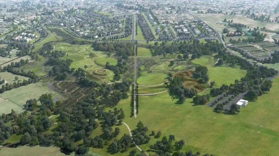
South Auckland is where catchment-scale planning is being tested at the largest scale in the region, because this is where the most land is changing use. New communities at Drury, Hingaia, Flat Bush and Pukekohe are turning farmland into suburb across catchments that drain to the Manukau Harbour and the streams of the southern basin.
Soft alluvial and peat soils, flat ground and sensitive receiving waters mean runoff, flooding and sediment all have to be managed across whole catchments, not site by site. LDE brings an integrated catchment view to this growth, combining surface-water and stormwater catchment modelling, flood-hazard assessment, and land-use and water-quality analysis within the freshwater policy framework.
Working under the Auckland Unitary Plan, we help developers and the council plan growth around how the catchments behave, and protect the streams and harbour downstream. For South Auckland clients, that means catchment management matched to the pace and scale of the region’s expansion.
How our South Auckland team delivers integrated catchment management
Across the southern growth corridor, catchment management is about staying ahead of large-scale land-use change. As farmland becomes suburb at Drury, Hingaia and beyond, runoff, flooding and sediment shift across whole catchments. Our team models these catchments as they develop, maps flood behaviour on flat, soft ground, and assesses the contaminant load reaching the Manukau and the southern streams, so growth can be planned around the catchment rather than after it.
Bringing the surface-water, flood and land-use picture together is the core of the work, drawing on our wider integrated catchment management capability and our water experience across the southern growth corridor.
- Catchment modelling of large-scale rural-to-urban change
- Flood-hazard mapping on flat ground with soft, low-permeability soils
- Stormwater catchment strategy with treatment and detention targets
- Sediment and water-quality assessment for the Manukau and southern streams
Freshwater planning in southern Auckland
Catchment and freshwater planning across the south sit under the Auckland Unitary Plan, administered by Auckland Council, which sets the freshwater objectives, limits and stormwater expectations that growth-catchment work has to meet. National freshwater direction shapes that framework, so we ground our modelling and assessment in the relevant policy and good practice.
- Ministry for the Environment and the National Policy Statement for Freshwater Management
- Water New Zealand good-practice guidance for catchment and stormwater management
LDE catchment management in southern Auckland
LDE applies integrated catchment thinking across the southern growth corridor, modelling how large subdivisions at Drury, Hingaia, Flat Bush and Pukekohe change runoff, flooding and the load reaching the Manukau and the southern streams. With soft soils and flat ground across the basin, much of our work is about setting catchment-scale flood, stormwater and water-quality targets so the wider urban development programme stays within what the catchments can absorb. You can see more of our regional water delivery on the projects page.
Common questions about integrated catchment management in South Auckland
Why does South Auckland growth need catchment-scale planning?
Because so much land is changing use at once. Without a catchment view, many separate subdivisions can each look acceptable while together they overload streams, worsen flooding and degrade the Manukau. Catchment management sets shared targets so the cumulative effect is managed.
How does this relate to the three-waters servicing for a subdivision?
Three-waters servicing builds the network for a development. Catchment management sits above it, modelling the whole catchment and setting the flood, stormwater and water-quality picture that each development’s servicing then has to fit, so growth across the basin holds together.
Who leads LDE’s South Auckland catchment work?
Chartered Professional Engineers and freshwater specialists from our team, supported by LDE modelling and planning specialists across the country.
Why does the Manukau matter to a southern catchment plan?
The Manukau Harbour and the southern streams are the receiving environment for the growth corridor, so their health reflects how the catchments are managed. We assess the sediment and contaminant load they receive under different growth scenarios and use it to set treatment and land-use targets across the catchment.