Coastal Engineering in Christchurch
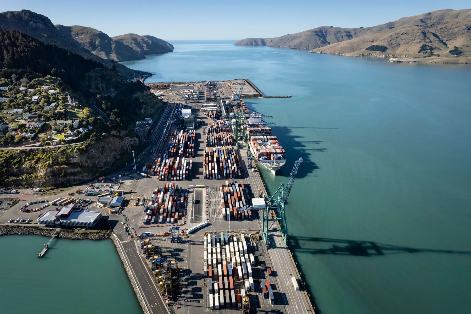
Christchurch has two very different coasts within a short drive of the city centre. To the east, Pegasus Bay is a long sandy shoreline backed by dunes, running from the Waimakariri River mouth south past New Brighton to the Southshore spit, which separates the open sea from the Avon-Heathcote Estuary Ihutai. To the south-east, the Port Hills and Banks Peninsula hold Sumner, a string of sheltered bays and Lyttelton Harbour Whakaraupō, with Lyttelton Port, the South Island’s largest, on the harbour’s northern shore. The 2010 and 2011 earthquakes changed this coastline. Land around the estuary and in the eastern suburbs subsided, leaving streets and sections lower relative to high tide and more exposed to flooding, storm surge and sea-level rise. LDE provides coastal and marine engineering for this setting, including coastal hazard and inundation assessment, dune and estuary edge management, seawall and revetment design, and advice on wharves and foreshore structures in the harbour. The work suits councils, port and infrastructure operators, developers and property owners who need coastal decisions that still hold up as the sea rises.
Send a Message
Enquire about your Christchurch project
How LDE delivers coastal engineering in Christchurch
Most coastal questions in Christchurch come back to water level. Where the ground dropped in the earthquakes, a king tide paired with an onshore storm now reaches further inland, and sea-level rise will push that line further again. We start with the design water level for the site, built up from tide, surge, wave setup and a sea-level allowance over the life of the asset, and then look at how the shoreline itself behaves. On the open Pegasus Bay coast that means dune condition and sand supply. Around the estuary and the harbour it means low banks, reclaimed edges and older walls.
This work draws on LDE’s national coastal and marine engineering capability, which also serves our ports, marine and coastal clients and the water and flood work that low-lying eastern Christchurch depends on.
- Coastal hazard and inundation assessment for subsided land in the eastern suburbs
- Dune management and beach access design along Pegasus Bay
- Edge protection around the Avon-Heathcote Estuary Ihutai
- Wharf, seawall and reclamation assessment in Lyttelton Harbour Whakaraupō
Coastal consenting and hazard planning in Canterbury
Seaward of mean high water springs, coastal structures and occupation are consented by Environment Canterbury under the Canterbury Regional Coastal Environment Plan. On land, Christchurch City Council administers the District Plan and building consents, and its district takes in Banks Peninsula as well as the city. Many coastal projects need consents from both, so we plan the investigation and reporting to serve each application at once.
- Ministry for the Environment coastal hazards and climate change guidance
- Natural Hazards Commission Toka Tū Ake natural hazard research and data
- Maritime New Zealand navigation safety around harbour structures
LDE coastal engineering around Christchurch and Banks Peninsula
Typical coastal work here falls into three groups. The first is hazard advice for land near the estuary, the Southshore spit and the lower reaches of the Ōtākaro Avon, where owners, developers and council teams need to know how often a site will flood and how that changes over the coming century. The second is the open coast, where dune erosion, beach access and stormwater outfalls cross a moving sandy shoreline. The third is the harbour and the bays of Banks Peninsula, where wharves, boat ramps, seawalls and road edges sit against the sea and often predate current design standards. These projects typically come from councils, port and marine operators, network owners and private landowners.
Common questions about coastal engineering in Christchurch
Why does earthquake subsidence matter for coastal design in Christchurch?
Parts of the eastern suburbs and the land around the estuary settled during the 2010 and 2011 earthquakes. Lower ground sits closer to the tide, so it floods from the sea and from backed-up drains more often, and each increment of sea-level rise has a larger effect. A coastal assessment here should use current ground levels, not pre-earthquake survey.
Can LDE assess wharves and seawalls in Lyttelton Harbour?
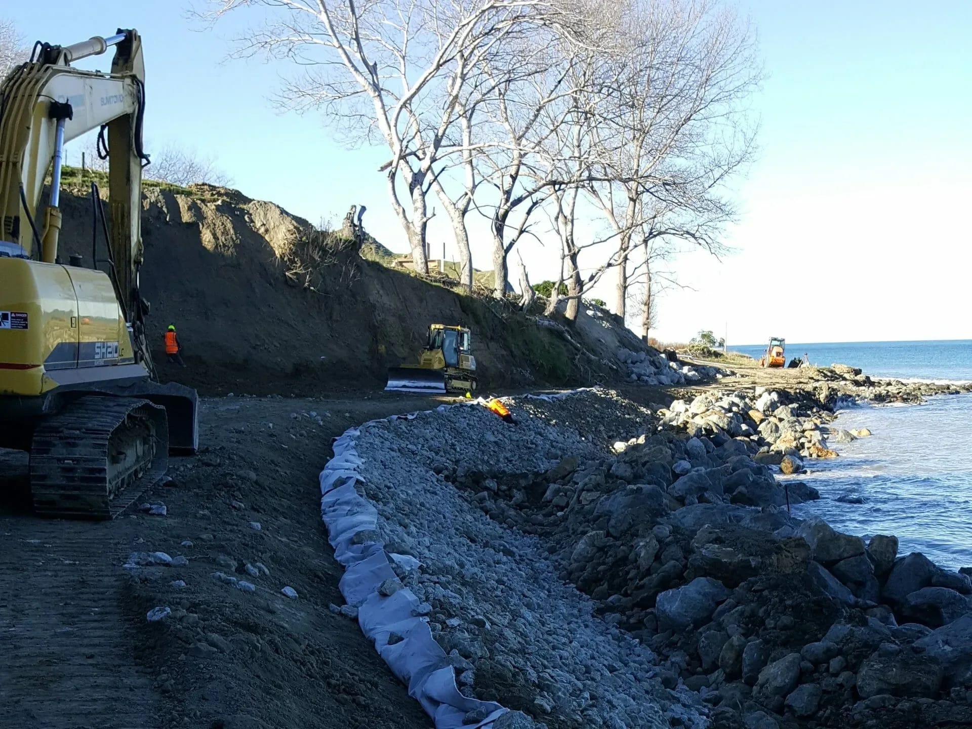
Yes. We inspect and assess existing wharves, jetties, seawalls and revetments, including older structures on reclaimed ground, and design repairs, strengthening or replacement. In Canterbury that assessment also covers seismic performance and the risk of liquefaction in the fill behind a wall.
Who leads LDE’s Christchurch coastal work?
Chartered Professional Engineers from our team, supported by LDE coastal and marine specialists nationally.
How is sea-level rise allowed for on a Christchurch project?
We follow the Ministry for the Environment coastal hazards guidance, which sets out a range of sea-level rise scenarios and asks for local vertical land movement to be included. For a building, road or wall, we test the design against those scenarios over its intended life and show where adaptation, such as raising levels later, will be needed.