Geotechnical Engineering in Christchurch
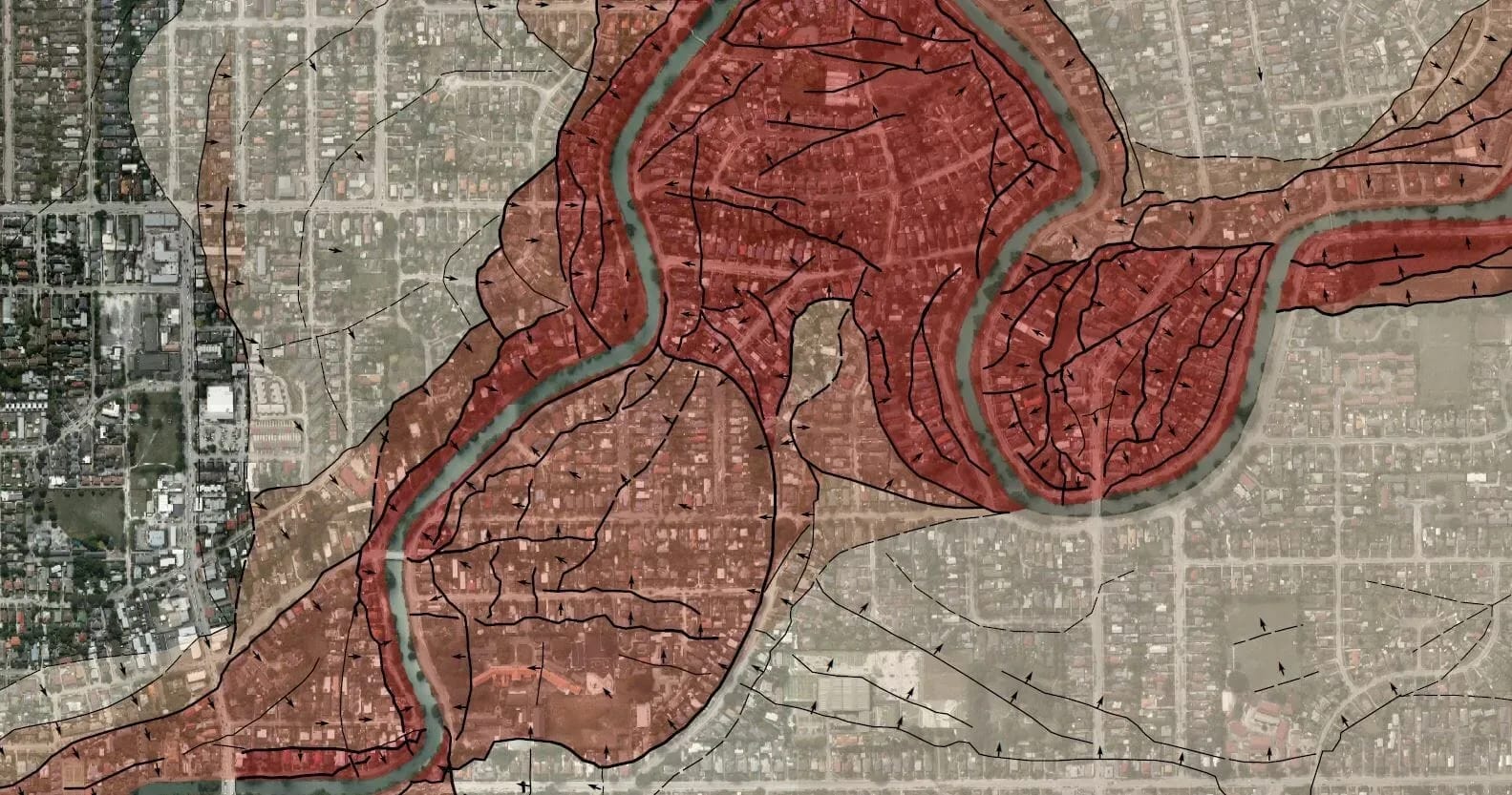
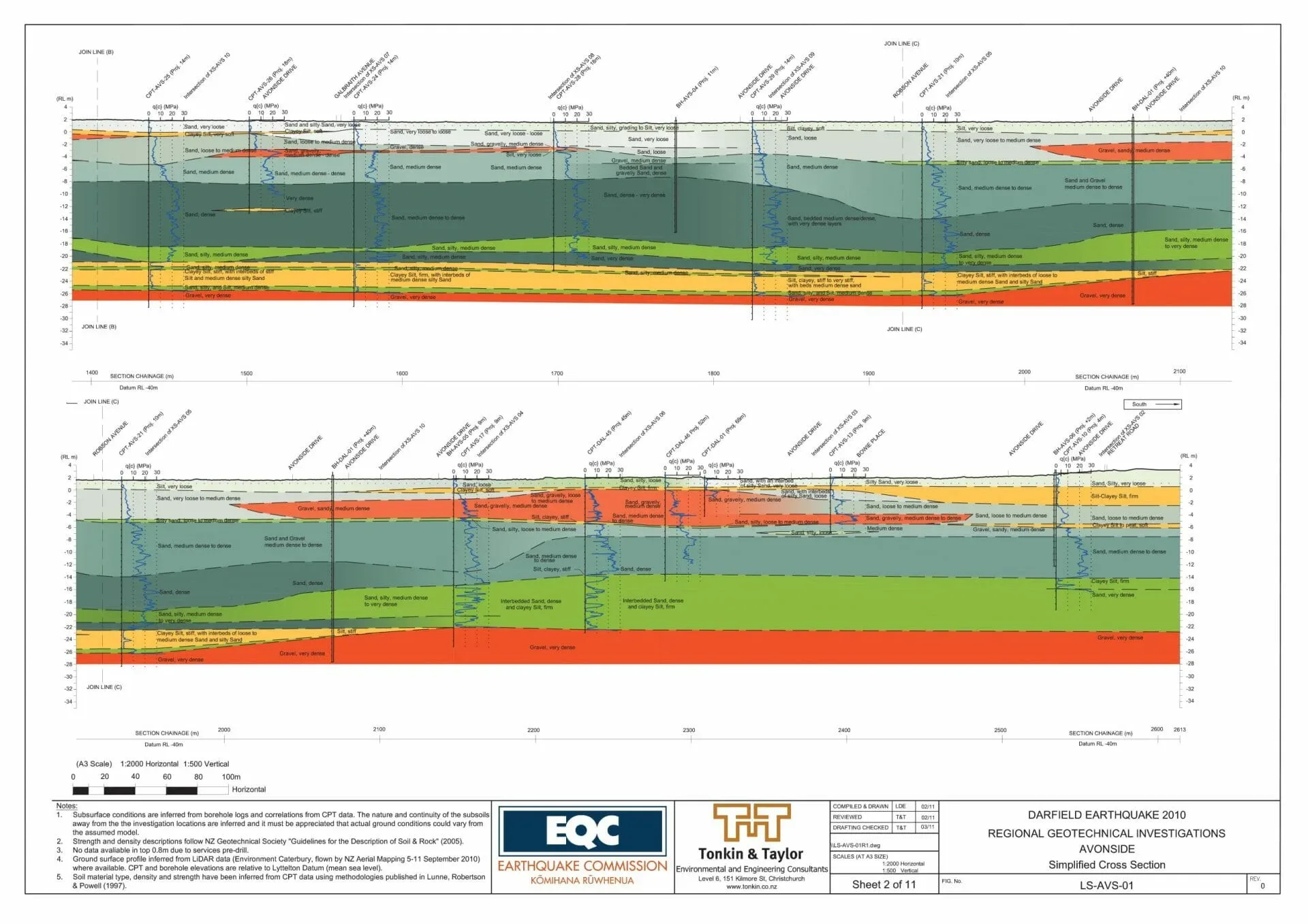
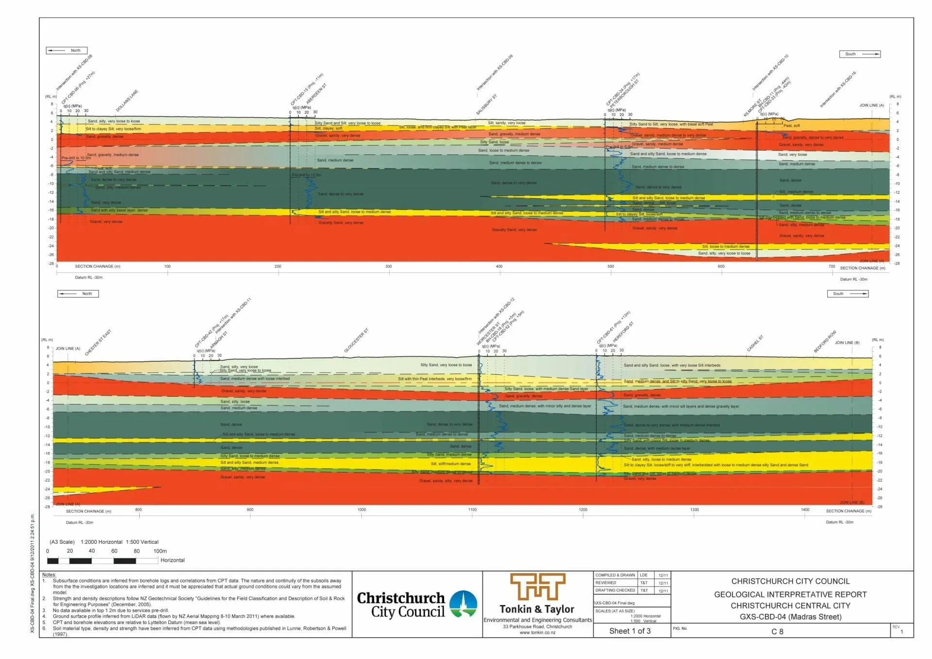
Ground behaviour decides a great deal of what gets built in Christchurch. The 2010 and 2011 Canterbury earthquakes caused liquefaction and lateral spreading across the eastern suburbs and along the Ōtākaro Avon River, and residential foundations on the flat land are still designed to the MBIE technical categories, TC1 to TC3, that came out of the recovery. The Port Hills bring a different set of problems. Loess soils there erode into tunnel gullies and slip when wet, and the volcanic slopes above Sumner, Redcliffs and Lyttelton Harbour carry rockfall and cliff-collapse hazard. Beneath the plains, deep alluvial gravels hold the confined artesian aquifers that supply most of the city’s drinking water, which affects how deep piles, bores and dewatering are planned. LDE provides geotechnical investigation, liquefaction assessment, foundation design and slope advice across Christchurch and Canterbury. Each investigation is planned around the technical category, the hazard mapping and what the consent will ask for.
Send a Message
Enquire about your Christchurch project
How LDE delivers geotechnical engineering in Christchurch
Most Christchurch investigations start with the technical category. On TC1 land a standard shallow investigation is usually enough. TC2 land typically takes an enhanced slab or a tied foundation. TC3 land needs a deep investigation, usually cone penetration tests, before the foundation type can be settled. On the hills the questions change to loess strength, slope stability and rockfall exposure, which call for mapping and test pits rather than a CPT rig.
The work draws on LDE’s national geotechnical engineering practice and supports our buildings and urban development work, so the ground model feeds straight into the structural and civil design.
- Deep investigation and foundation design for TC2 and TC3 residential sites
- Liquefaction and lateral-spreading assessment near the Ōtākaro Avon and Ōpāwaho Heathcote rivers
- Loess slope stability, retaining design and rockfall assessment on the Port Hills
- Pile and dewatering design that protects the confining layers above the artesian aquifers
Consenting and ground hazards in Canterbury
Christchurch City Council issues building consents and administers the Christchurch District Plan, which maps natural hazards including liquefaction and Port Hills slope instability. Environment Canterbury manages groundwater under the Canterbury Land and Water Regional Plan, so dewatering and new bores can need consents of their own. We scope investigations and reports to satisfy both councils.
- MBIE guidance on repairing and rebuilding houses affected by the Canterbury earthquakes
- MBIE geotechnical guidance under Building Code clause B1
- New Zealand Geotechnical Society earthquake geotechnical engineering practice series
Seismic surveying and wireline geophysics in Canterbury
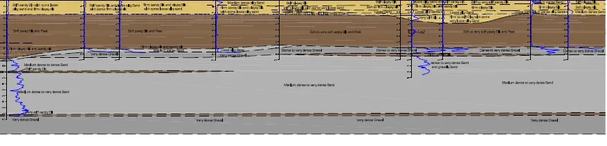
Canterbury gravels are hard on intrusive testing. A CPT can refuse on a dense gravel layer well short of the depth a TC3 assessment or a deep pile design needs, and drilling through the gravels is slow and costly. Surface seismic methods fill the gaps between the holes we can afford to drill.
- MASW and seismic refraction for shear-wave velocity and site subsoil class
- Wireline logging in boreholes to tie velocity profiles to the logged gravel and silt layers
- Mapping of depth to gravel across a site to support pile length estimates
- Electrical resistivity imaging where shallow groundwater or old fill is the concern
Each survey is interpreted against the CPT and borehole record and reported by the engineers writing the geotechnical report. Method detail is on our geophysics page.
LDE geotechnical engineering in Canterbury
Canterbury commissions fall into a few groups. Homeowners, builders and designers bring TC2 and TC3 sections and rebuilds on the flat land, and hillside sites in the Port Hills where loess and rockfall shape the design. Developers need subdivision investigations for greenfield growth on the city fringe and in Selwyn and Waimakariri districts. Commercial and public clients need foundation design for central city buildings, where deep gravels, shallow groundwater and the artesian aquifers all bear on the pile design. Asset owners ask for ground advice on roads, pipelines and flood-protection works near the Waimakariri River, the city’s rivers and the Avon-Heathcote Estuary.
Common questions about geotechnical engineering in Christchurch
How do I find the technical category for my Christchurch property?
Search the address on Canterbury Maps, which carries the MBIE technical category layer, and check the land information memorandum (LIM). The category tells you what level of investigation and foundation the MBIE guidance expects. Port Hills and Banks Peninsula land, rural land and non-residential urban land have no category, and foundations there follow site-specific design or the normal consent process.
Why does TC3 land need a deep investigation?
On TC3 land, liquefaction in a future earthquake could cause significant settlement or lateral spreading. The MBIE guidance asks for a deep investigation, usually CPTs, so the foundation, whether a relevellable surface structure, deep piles or ground improvement, is chosen on measured ground data.
Does LDE assess rockfall and slope hazard on the Port Hills?
Yes. We map the slope, test the loess and assess rockfall and cliff-collapse exposure, then design retaining, drainage or protection works where the site needs them. Sites inside the District Plan’s Port Hills hazard overlays usually need a geotechnical report with the consent application.
Who leads LDE’s Christchurch geotechnical work?
Chartered Professional Engineers from our team, supported by LDE specialists nationally.
Canterbury